
The last transmission cycle seems to have been a quiet one; four owls checked in, and they pretty much stuck to where they’d been the last time they sent in data.
Millcreek hadn’t checked in for more than a week, but he was just off the Buffalo waterfront, stubbornly clinging to what’s left of the ice of Lake Erie, which now occupies only a small portion of the easternmost toe of the lake.
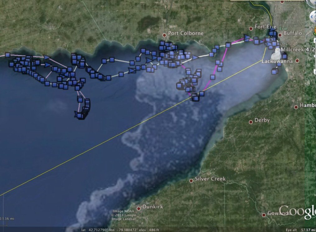
Millcreek’s latest movements in dark purple, on the ever-shrinking ice of eastern Lake Erie. The screenshot also shows a bit of Womelsdorf’s old tracks to the west. (©Project SNOWstorm and Google Earth; MODIS ice imagery by NOAA CoastWatch)
As you can see from this overlay of the MODIS ice imagery from April 24, there’s not much left, but April 20-21 Millcreek was out near the ice edge — as always, a good place to hunt. But by the 23rd he was back to Buffalo Harbor, a place he’d visited at the beginning of April, within shouting distance of the Peace Bridge over the Niagara River.
Oswegatchie really, really likes his little patch of farmland near the small town of Casselman, Ontario, where he’s been since April 10. Here’s what the area looks like in Google Street View (in summer, obviously); the appeal for a snowy owl is obvious:
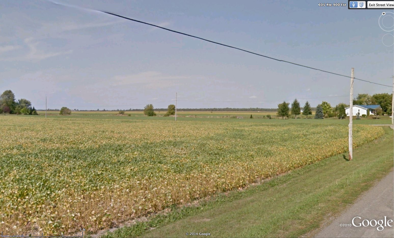
The view in summer a few kilometers from where Oswegatchie has been hanging out. (©Google Earth)
What’s less obvious is that the fact that it’s pretty isolated. The nearest road in most directions is anywhere from two to five miles (3-8 km), and while there is one paved road within .6 mile (1km) from his haunts, it dead-ends at a farm. My only worry is that he’s hunting along an active railroad track, but the traffic is obviously going to be a whole lot less frequent than a highway.
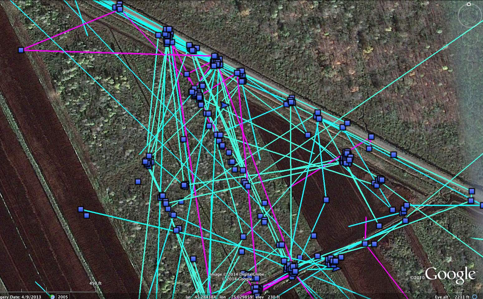
Those clusters of perch locations exactly 40m apart along the railroad bed are Oswegatchie’s favorite utility-pole hunting perches. (©Project SNOWstorm and Google Earth)
It’s interesting to look at his perches (older tracks are in pale blue, the latest ones in purple). You can see just where the utility poles are placed along the tracks, exactly 40 m (43.7 yards) apart.
Amishtown is still hanging out at the north end of Georgian Bay, near Killarney, Ontario — out on the ice, but also onshore at George Island and Badgeley Island:
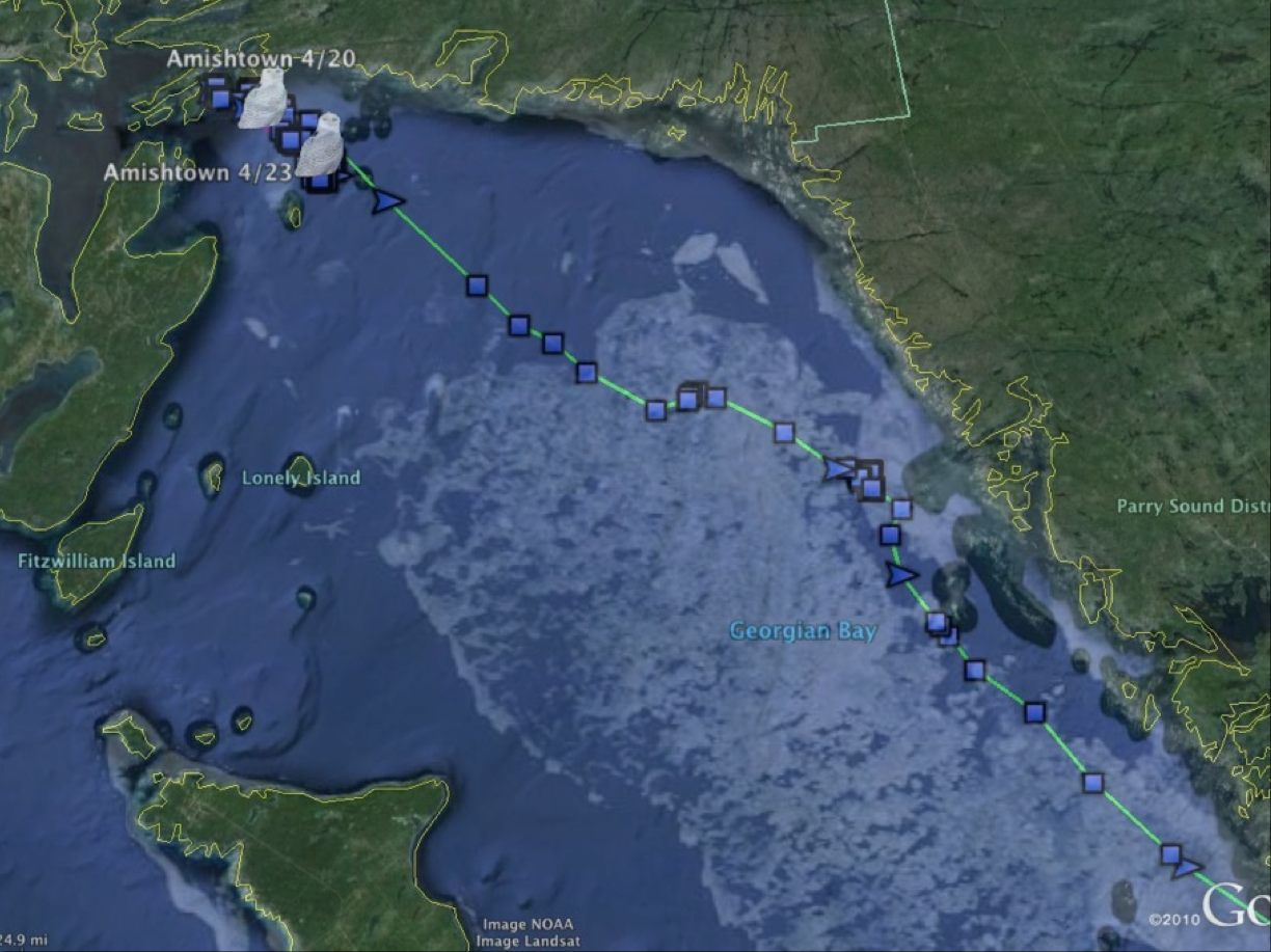
The receding ice on northern Georgian Bay, where Amishtown is hanging out, (©Project SNOWstorm and Google Earth; MODIS ice imagery by NOAA CoastWatch)
Finally, Kewaunee is loafing on Green Bay after his flight to the UP of Michigan last weekend. There’s still a lot of ice cover on the bay, but that’s increasingly rotten, and a fresh warm spell will eliminate a lot of it.
There are several owls that were in southern Canada when the last checked in, but which have dropped off the grid the last couple of cycles. We can’t be sure if they’re still somewhere that just has spotty cell coverage, or if they’ve moved north of the fairly narrow cell band in southern Ontario and unlikely to check in again this season. These include Braddock (last transmission April 14), Womelsdorf (April 17) and Erie (April 14). The same could be true of Marshfield (April 8, last heard from on Mille Lacs Lake in northeastern Minnesota) and Century (April 5 on the southern edge of the Adirondacks near Saratoga, NY).

5 Comments on “April 26 update”
You guys have done an outstanding job tracking these snowy owls. Been following your tracks thru my son sending me the information. Would like to receive it at my email, don’t know why as I did contribute this year and will next year, but those things happen sometimes.
There have been 2 -3 in Duxbury, MA by the beach this past week. 1 visable today.
Any info on FREEDOM?
All the maps are updated with the latest data for each bird (allowing for our usual three-day safety delay), so you can see what we have for all the owls. The last transmission we had from Freedom was on the evening of March 9, when she was about 1.5 miles southeast of Freedom, WI, in the same area she’d been hunting all winter. Her transmitter had experienced a weird power drop at the end of February, its voltage falling below 3.2v and going into “hibernation,” but it had come out of sleep mode and was recording normally on the 9th. It failed to reconnect three days later on schedule, nor did it check in on the first of the month, when the transmitters are programmed to send a low-power “I’m here” message if they have any juice at all. So there are three possibilities. Her transmitter may have had a technical glitch and failed; she have been killed in such a way that either knocked out the transmitter (electrocution or a vehicle collision being most likely) or left it unable to recharge sufficiently to communicate (lying on her back, blocking the solar panel); or she moved to and has remained in a place with no cell reception. At this point, sadly, I think the first two are more likely than the third, and given the unexplained power drop I tend to think it was a transmitter issue.
You need targeted visitors for your April 26 update – Project SNOWstorm website so why not try some for free? There is a VERY POWERFUL and POPULAR company out there who now lets you try their website traffic service for 7 days free of charge. I am so glad they opened their traffic system back up to the public! Sign up before it is too late: http://papug.tk/skroc/o